Interpolate point depth data to a raster
interpolate_points.RdInterpolate point depth data to a raster
Usage
interpolate_points(
  depth_points,
  shoreline,
  islands = NULL,
  crs,
  res = 2,
  method = "nn",
  n = 1,
  m = 1,
  h = 8,
  print_plot = TRUE
)
Arguments
- depth_points
sf object of depth points or a dataframe of points with columns 'lon' and 'lat'. Must contain a "depth" column. If NULL, then contours must be provided. If NULL, then contours must be provided.
- shoreline
sf object of lake shoreline.
- islands
sf object of lake islands if present.
- crs
target coordinate reference system: object of class
crs, or input string for st_crs- res
numeric resolution of output raster in metres.
- method
character interpolation method. Options are c('MBA', 'tps', 'nn', 'idw'). Default is 'nn' (nearest neighbor). 'MBA' uses the MBA::mba.surf function, 'tps' uses a thin plate spline from the fields package, 'nn' uses nearest neighbor interpolation from the terra package, and 'idw' uses inverse distance weighting from the terra package.
- n
initial size of the spline space in the hierarchical construction along the x axis. If the rectangular domain is a square, n = m = 1 is recommended. If the x axis is k times the length of the y axis, n = 1, m = k is recommended. The default is n = 1.
- m
initial size of the spline space in the hierarchical construction along the y axis. If the y axis is k times the length of the x axis, m = 1, n = k is recommended. The default is m = 1.
- h
Number of levels in the hierarchical construction. If, e.g., n = m = 1 and h = 8, the resulting spline surface has a coefficient grid of size \(2^h\) + 3 = 259 in each direction of the spline surface. See references for additional information.
- print_plot
logical print plot of interpolated raster.
Examples
shoreline <- readRDS(system.file("extdata/rotoma_shoreline.rds",
package = "bathytools"))
depth_points <- readRDS(system.file("extdata/depth_points.rds",
package = "bathytools"))
depth_points <- generate_depth_points(shoreline = shoreline,
depth_points = depth_points)
#> Generating depth points... [2025-08-25 02:35:01]
#> Finished! [2025-08-25 02:35:01]
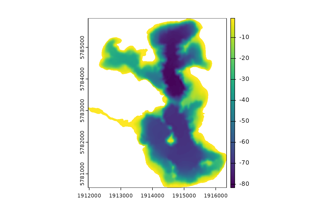
bathy_raster <- interpolate_points(depth_points = depth_points, shoreline = shoreline,
crs = 2193)
#> Interpolating to raster... [2025-08-25 02:35:01]
#> Adjusting depths >= 0 to -0.81 m
#> Finished! [2025-08-25 02:37:13]