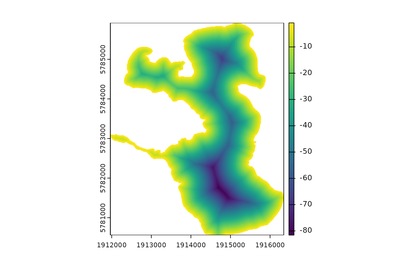
Estimate bathymetry from a shoreline polygon using distance transformation.
estimate_bathymetry.RdThis function estimates the bathymetry of a lake from a shoreline polygon using a distance transformation. The function calculates the distance from the shoreline polygon to the edge of the lake and uses this distance to estimate the bathymetry. The maximum depth of the lake is provided as an input parameter. This is the formula used in the Hollister and Milstead (2010) paper.
Arguments
- shoreline
sf object of lake shoreline.
- hypsograph
data.frame. A hypsograph data frame with columns 'depth' and 'area'. If provided, the function will use the hypsograph to estimate the bathymetry. If not provided, the function will use a linear scaling based on the maximum depth.
- max_depth
numeric. The maximum depth of the lake.
- res
numeric resolution of output raster in metres.
References
Hollister, J. W., W.B. Milstead (2010). Using GIS to Estimate Lake Volume from Limited Data. Lake and Reservoir Management. 26(3)194-199. doi:10.1080/07438141.2010.504321
Examples
shoreline <- readRDS(system.file("extdata/rotoma_shoreline.rds",
package = "bathytools"))
max_depth <- 81.6
bathy <- estimate_bathymetry(shoreline = shoreline, max_depth = max_depth)
terra::plot(bathy)